
Informed Solutions has over 30 years’ experience delivering complex geospatial solutions across the Environment, Transport, Energy & Utilities, and Policing and Emergency Response sectors.
National and enterprise clients include the UK, Scottish and Australian governments, the Royal Mail Group, BT and Maersk. Recent work with The Crown Estate received a ‘Special Achievement in GIS Award’ at the 2024 ESRI World User Conference in California, while InformedINSIGHT™, deployed at NatureScot, won the Environment and Sustainability Award at the 2025 AGI Awards for its pioneering use of geospatial intelligence in large-scale ecosystem monitoring.
We lead and shape best practice in geospatial standards (UK Geospatial Data Standards Register, INSPIRE, UK Gemini, OGC, Q-FAIR) and deliver award-winning land models, spatial frameworks, and national-scale solutions. We’re a proud Associate Member of AGI, with two former AGI Council Chairs, four former Council Members, and the current Chair of AGI Greater Manchester among our team.
With a history of innovation that delivers high-performing digital and data solutions, we were the first company in the world to put maps and location-enabled services on mobile phones in 2002. In Australia, we created SEED, Australia’s first whole-of-Government Environmental Data Portal, laying the foundation for greater transparency and improved decision-making on environmental matters across New South Wales.
We haven’t stopped innovating: We developed and launched the world’s first AI-powered digital planning and land management platform, which manages the sustainable development and protection of land across Scotland.
Trusted and Proven
Our technology-independent geospatial expertise covers the entire lifecycle – from Discovery through to Live – using leading commercial and open-source technologies and our Queen’s Award-winning InformedTRANSFORM™ framework to ensure our solutions realise their intended business outcomes.
Learn more about InformedTRANSFORM™ and how it can help you set the right path to accelerated transformation.


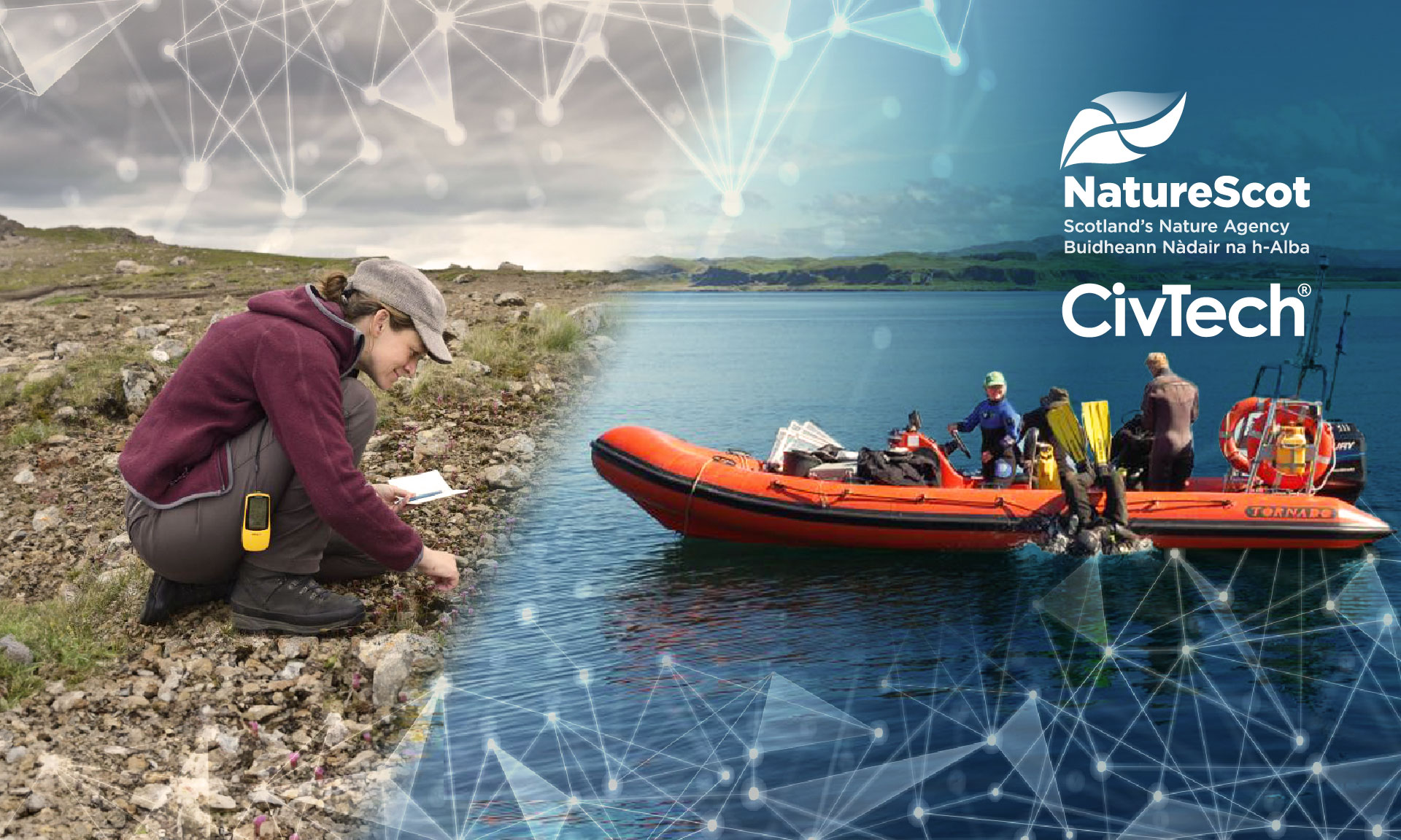


NatureScot
Transforming Sustainable Land Asset Management with AI
At NatureScot, InformedINSIGHT™ has transformed the management of area monitoring, driven scalability and efficiency, and helps it identify signs of environmental stress much earlier for interventions in support of reaching the 30 by 30 biodiversity restoration target in Scotland. The national, scalable cloud-based platform integrates a broad range of evidence sources (including Earth Observation (EO) data, such as satellite imagery and eDNA, as well as historical documents and records from years of previous monitoring work) to create actionable, ‘decision-ready’ data for area monitoring teams, embedded in a tailored, intuitive user-centred workflow.
The Crown Estate
Co-developed the ESRI Special Achievement Award winning and market-leading Resource Identification and Optimisation (RIO) system for Geospatial Analysis and Modelling. RIO supports marine activity licensing, forward planning, scenario modelling, and environmental stewardship, helping The Crown Estate manage and balance sustainable use of the UK seabed through advanced marine spatial planning.

Sellafield
Nuclear Remediation and Decommissioning
Sellafield’s £40bn decommissioning programme uses InformedINSIGHT™, a smart data hub and Land Quality Management System, which is transforming Sellafield’s remediation and decommissioning of the nuclear site. At Europe’s largest industrial nuclear site, Sellafield, InformedINSIGHT™ has replaced seven legacy systems, managing 40 years of scientific land quality information and real-time feeds, including Earth Observation, to provide location intelligence and decision support for site decommissioning and remediation.

Sharing and Enabling Environmental Data (SEED)
In Australia, New South Wales’ SEED has leveraged InformedINSIGHT™ to power a groundbreaking, multi-award-winning service for environmental data sharing and decision making. A first-of-its-kind in Australia, this state-wide environmental data portal, integrates 1200-plus land, water and air datasets from agencies responsible for environment, planning, resources and energy, primary industries, industry, water and spatial services into an innovative platform that set new benchmarks for transparency and enabled enhanced data-driven insights and decision-making on critical environmental and land management issues.

Department for Business and Trade
Delivered the IRIS, L!SA and VISTA geospatial planning applications for the Department for Business and Trade’s National Digital Twin Programme, enabling integrated spatial planning, data sharing and modelling to support better infrastructure and land use decision-making.

Registers of Scotland (RoS)
Designed and delivered a groundbreaking GIS-based Crofting Register, one of the first GIS platforms in the UK to use crowd-sourcing alongside advanced Geospatial Analysis and Modelling to create a new register of Crofts and Common Lands for Scotland. Developed within a demanding, high profile Scottish Parliamentary deadline, the fully scalable digital register integrates cloud, Open-Source technologies, and Open Mapping Standards. It is widely recognised as an exemplar in the delivery of ‘Digital by Default’ public services – increasing government’s engagement with the public, whilst delivering a more efficient and cost-effective service.

Royal Mail
Delivered the First and Final Mile Optimisation Service for Royal Mail, using best-in-class geospatial technology to enable real-time planning of collections and deliveries for over 30 million addresses every day.

Talk to Us
To find out more about our geospatial intelligence services, speak to one of our experts.